Digital Hillslope Position Image Gallery
| Updated:
Author: Bradley Miller
Author: Bradley Miller
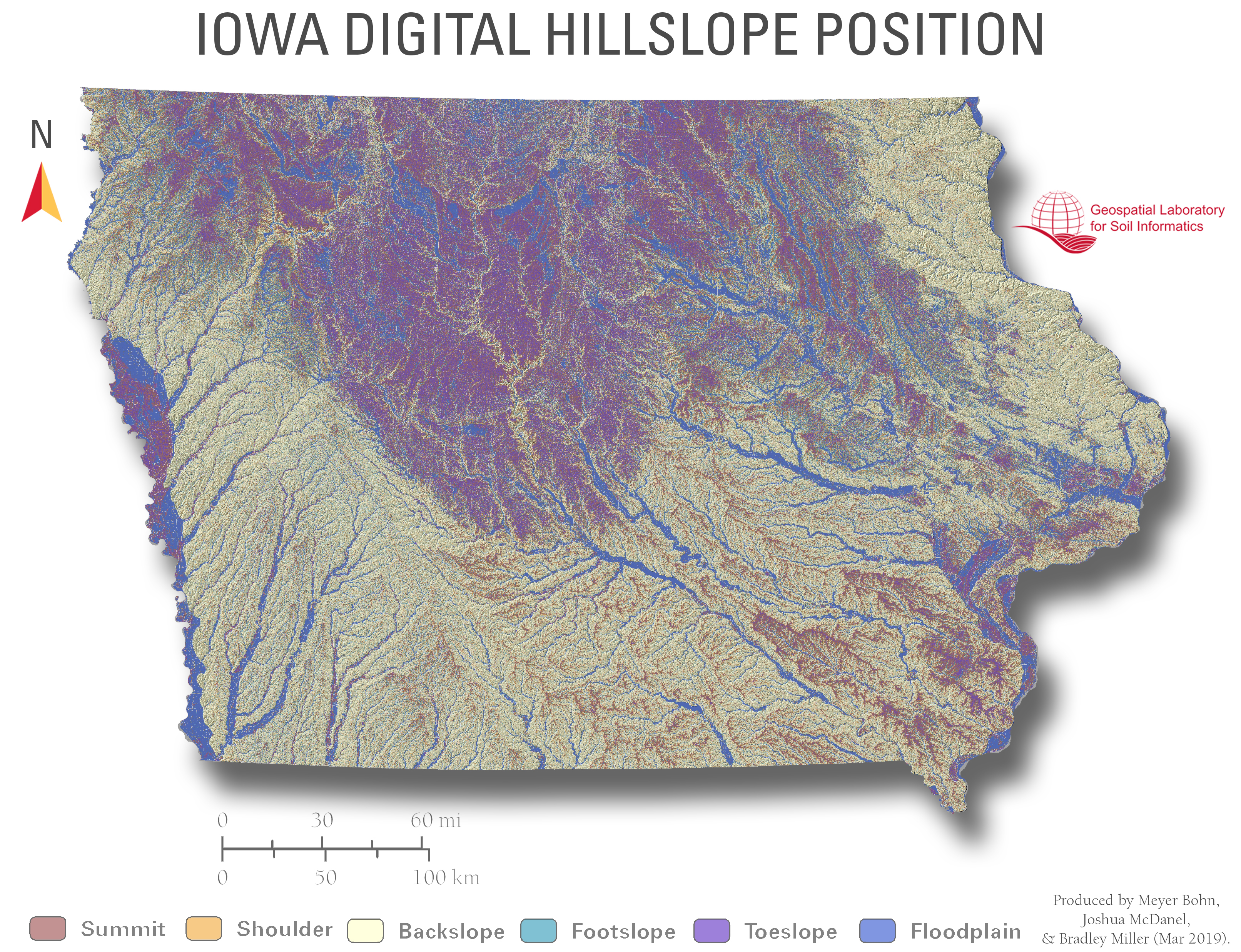
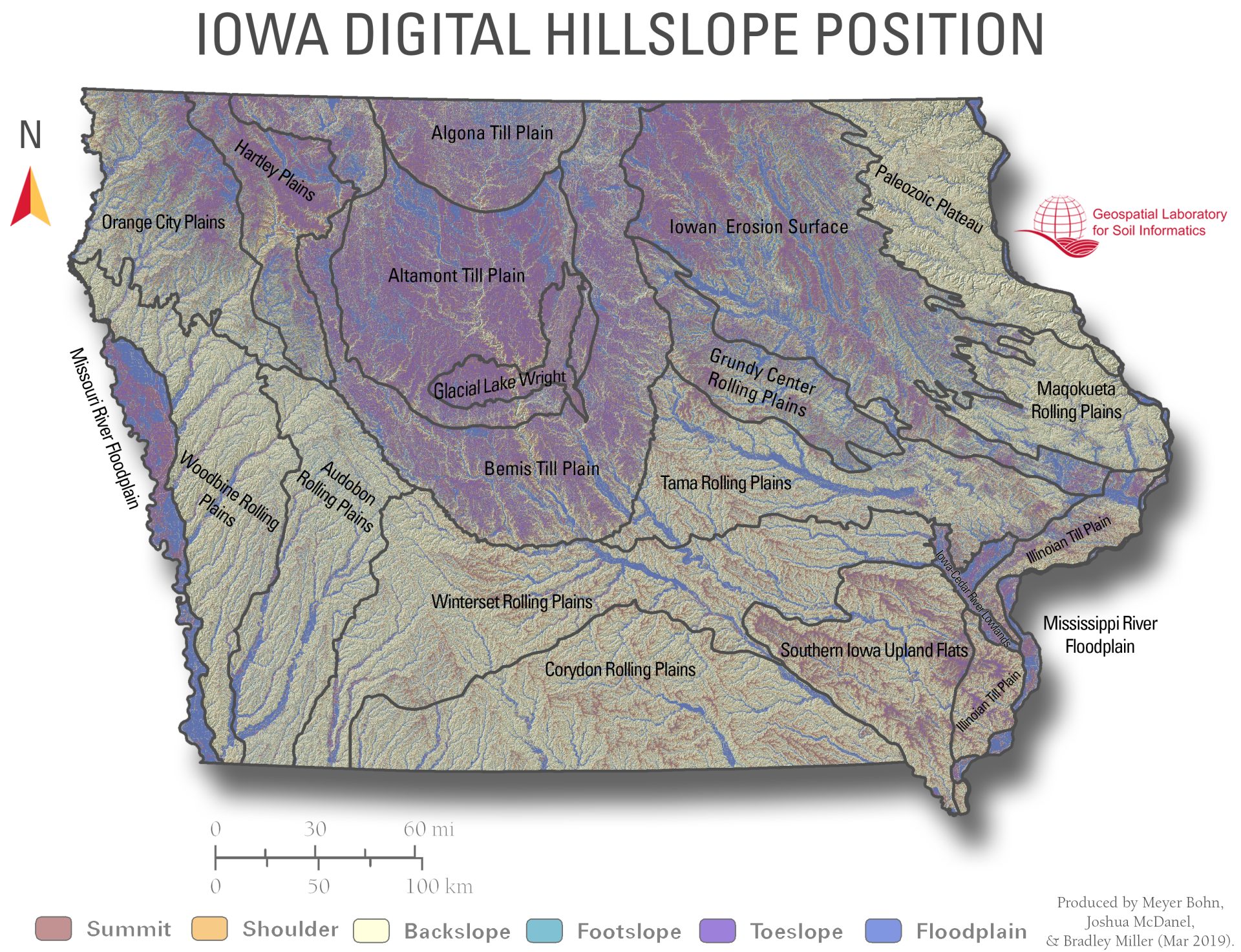
DHPFP can be used to infer patterns of soil drainage, erosion risk, and landscape stability. For example, summits often support well-developed, stable soils, while backslopes and footslopes are more prone to erosion or accumulation. Floodplains typically contain poorly drained, frequently saturated soils. This classification supports conservation planning, digital soil mapping, hydrologic modeling, and precision agriculture.
This is a surface-based classification and is not depth-dependent. However, it can be paired with soil property datasets (e.g., organic matter, water retention) to explore vertical variation across slope positions.
To save images, right click image and select “save as” to download.