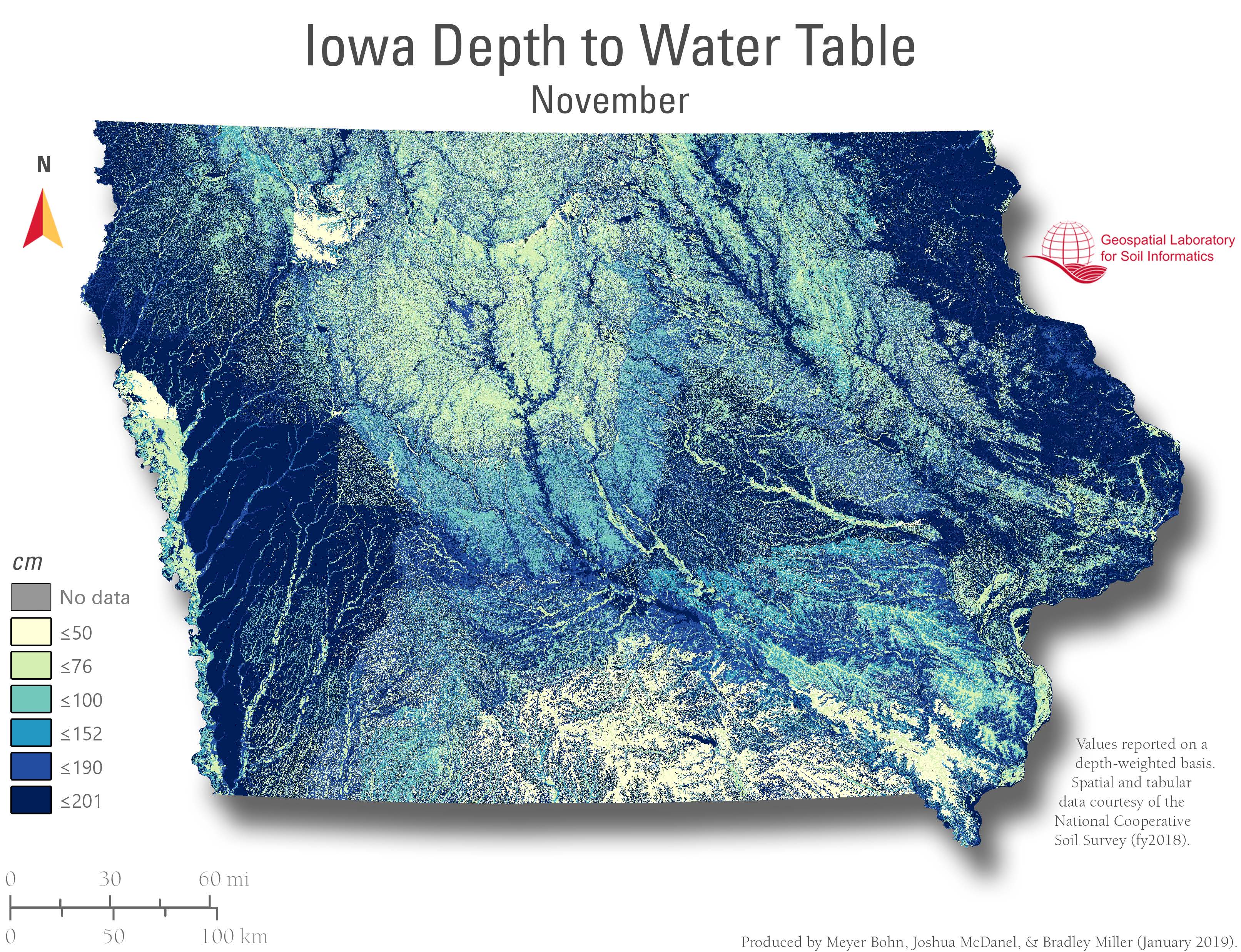
Depth to water table is the vertical distance from the ground surface to the top of the saturated zone. Small values indicate near-surface saturation (poor drainage); larger values indicate deeper groundwater and better aeration. These monthly Iowa maps show estimated conditions through the year, revealing seasonal wetness patterns along valleys, terraces, and uplands. Depth classes are in meters—see each map legend.
Applied Relevance
Water-table depth drives soil aeration, bearing strength, and timing of field operations. Shallow depths raise risks of waterlogging, rutting, denitrification, and nutrient loss; deeper depths support rooting and trafficability. The maps help target tile-drain design and outlet placement, schedule planting/harvest, screen sites for basements and septic systems, prioritize wetland protection/restoration, and identify areas more vulnerable to contamination and flooding.
Available Months
January, February, March, April, May, June, July, August, September, October, November, December, Animated overview (GIF).