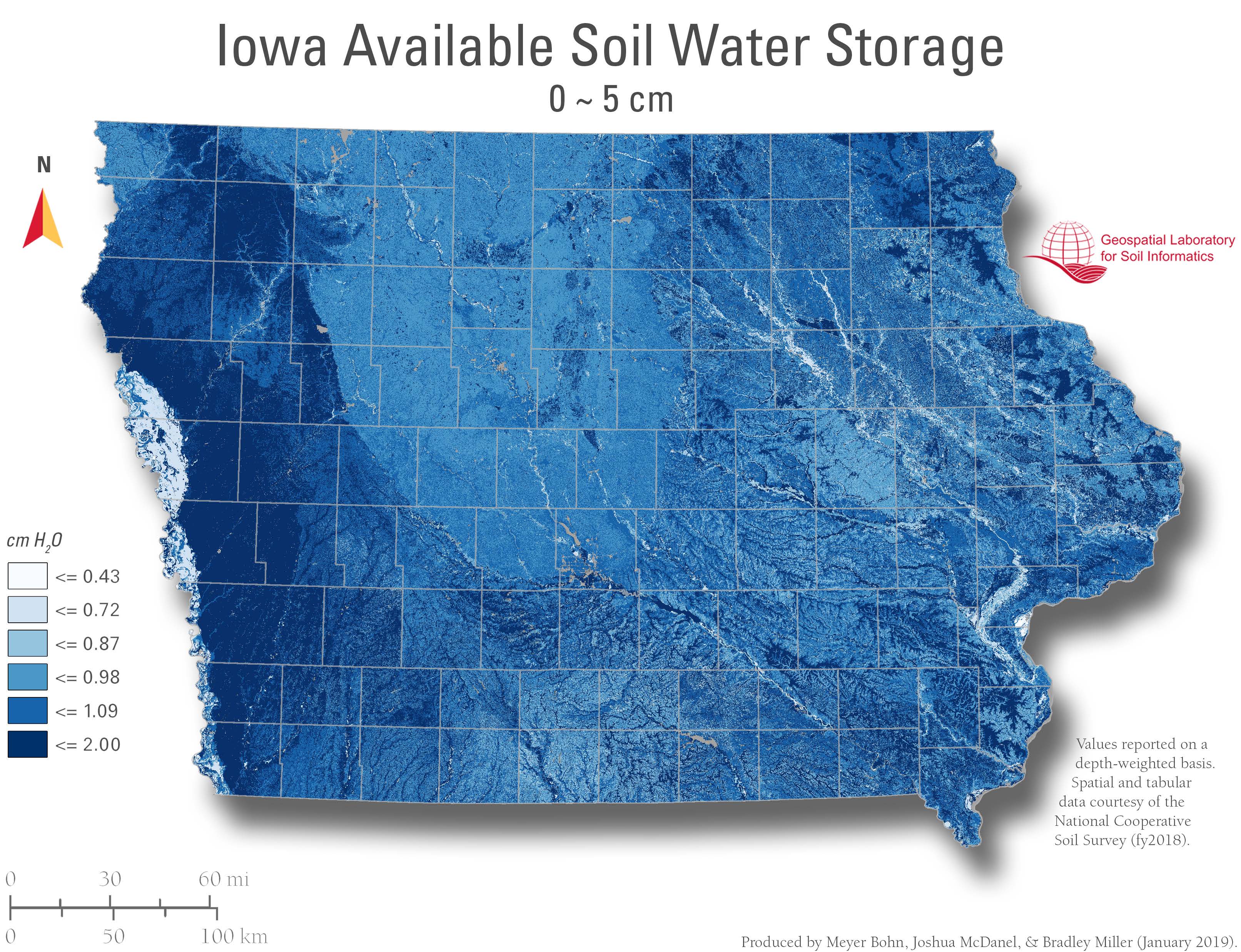
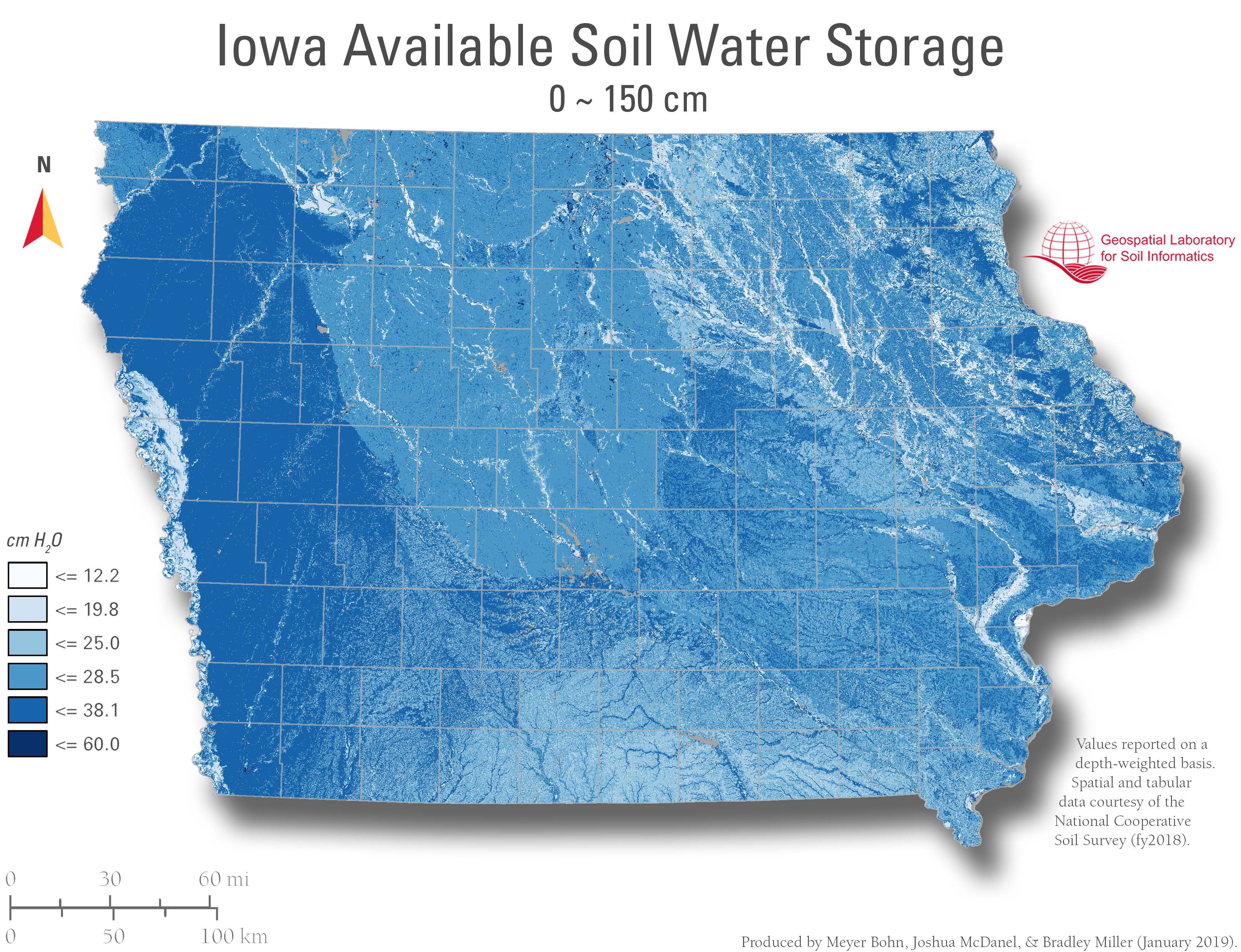
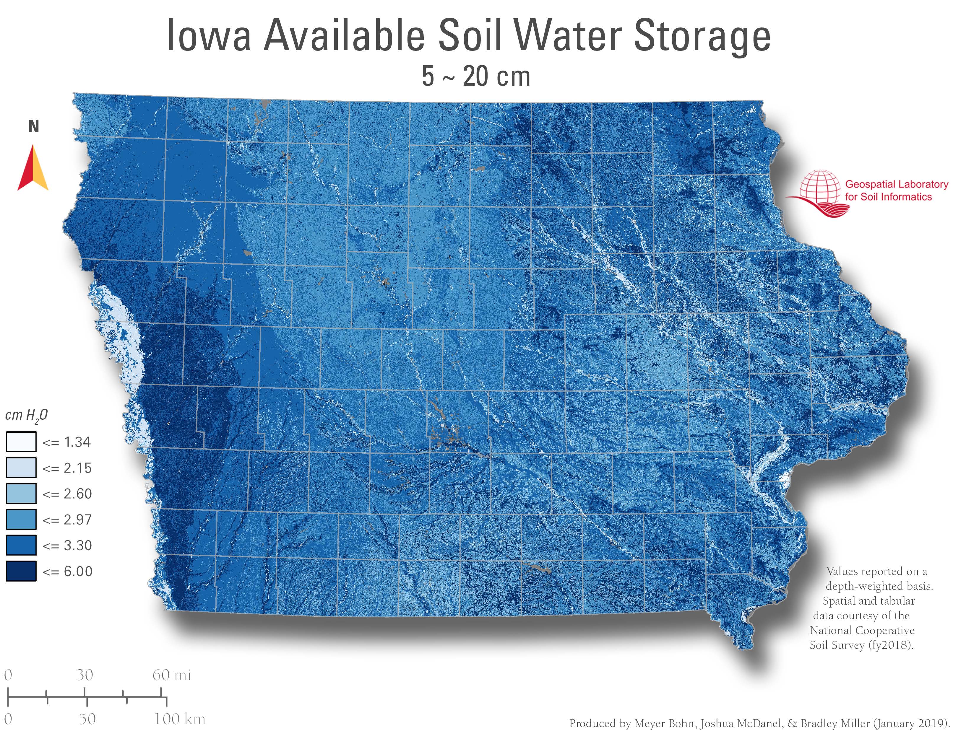
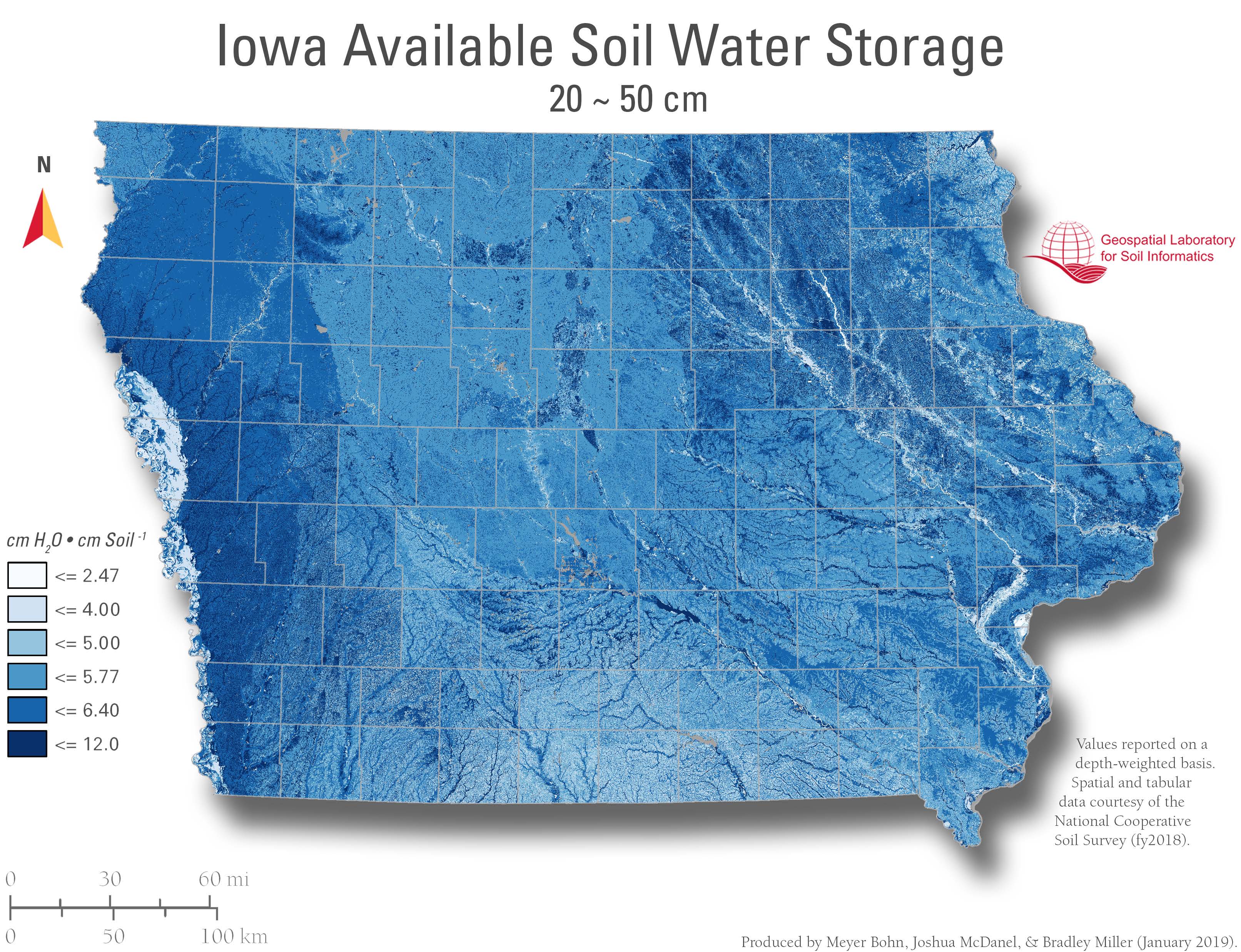
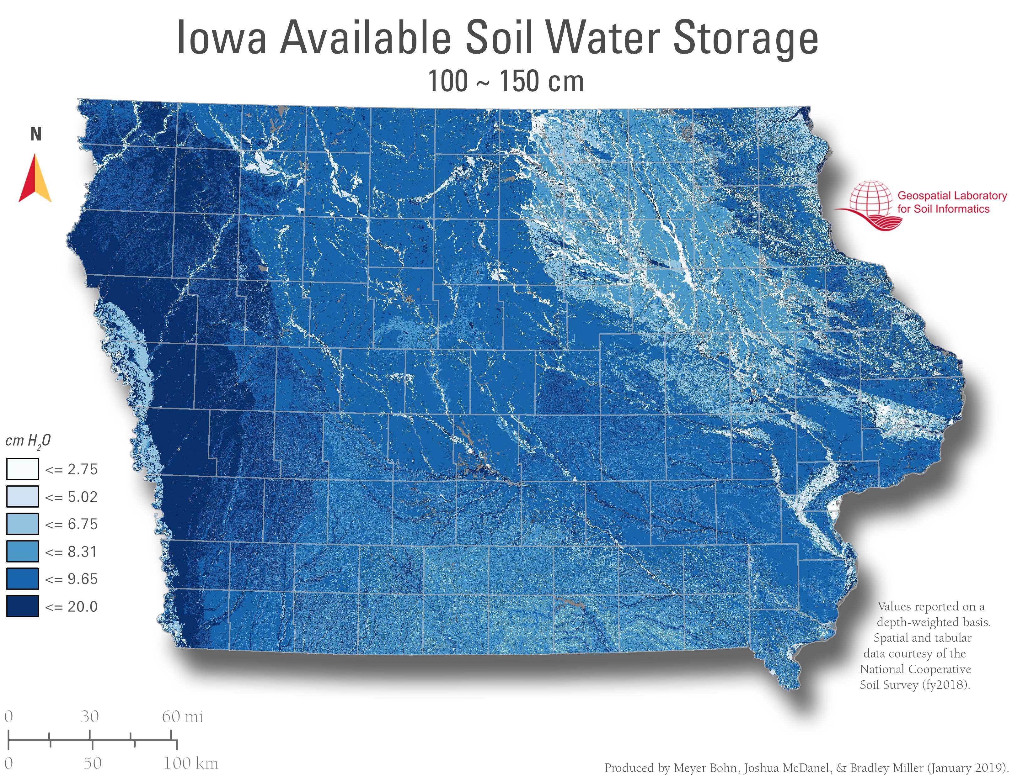
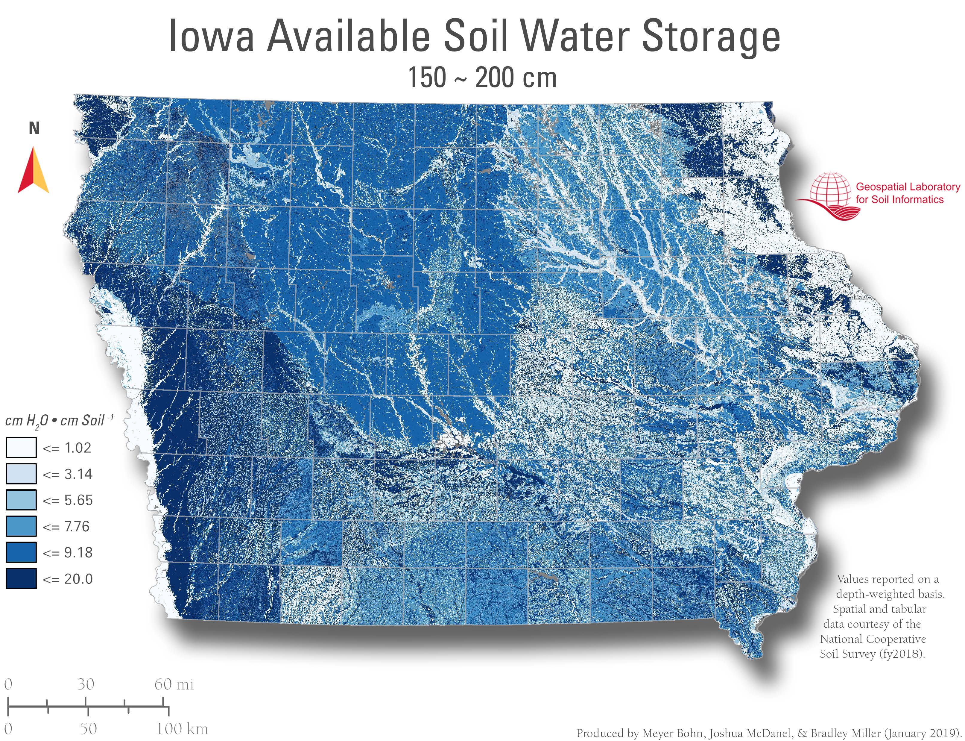
Available water storage (AWS) is the total volume of water (in centimeters) that should be available to plants when the soil, inclusive of rock fragments, is at field capacity. It is commonly estimated as the amount of water held between field capacity and the wilting point, with corrections for salinity, rock fragments, and rooting depth. AWS is reported as a single value (in centimeters) of water for the specified depth of the soil. AWS is calculated as the available water capacity times the thickness of each soil horizon to a specified depth.
Applied Relevance
AWC informs crop selection and irrigation design. While it does not reflect real-time water content, it supports estimates like available water supply (AWS) using soil depth (e.g., AWC × depth = AWS). These values help manage water resources for agriculture and conservation planning.
Available Depths
Maps and data layers available for the following cumulative depth intervals:
0–5 cm, 0–20 cm, 0–25 cm, 0–30 cm, 0–50 cm, 0–100 cm, 0–150 cm, and 0–200 cm