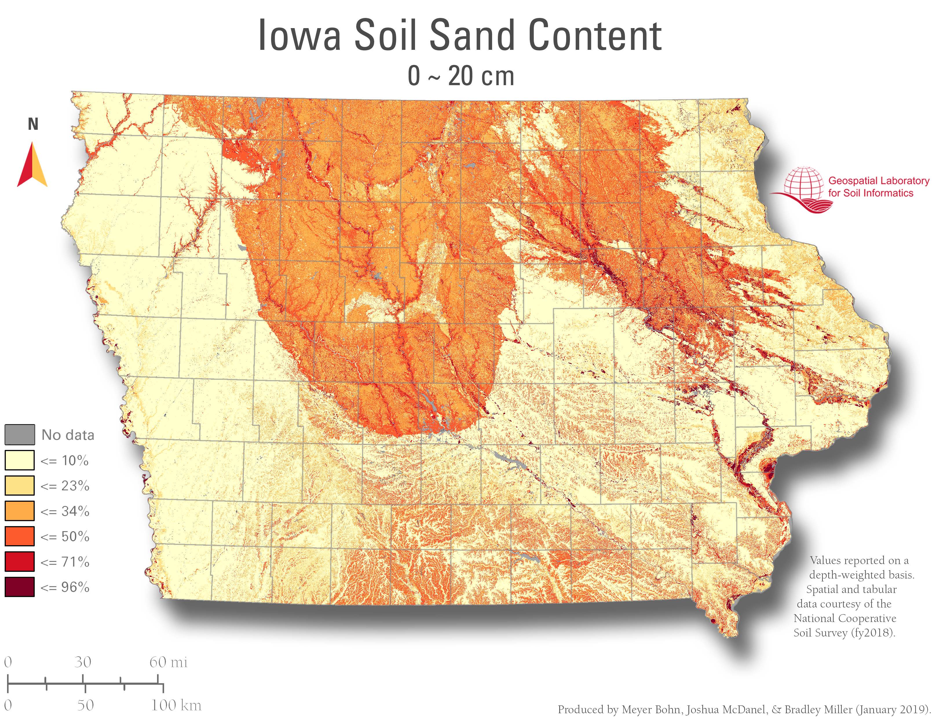
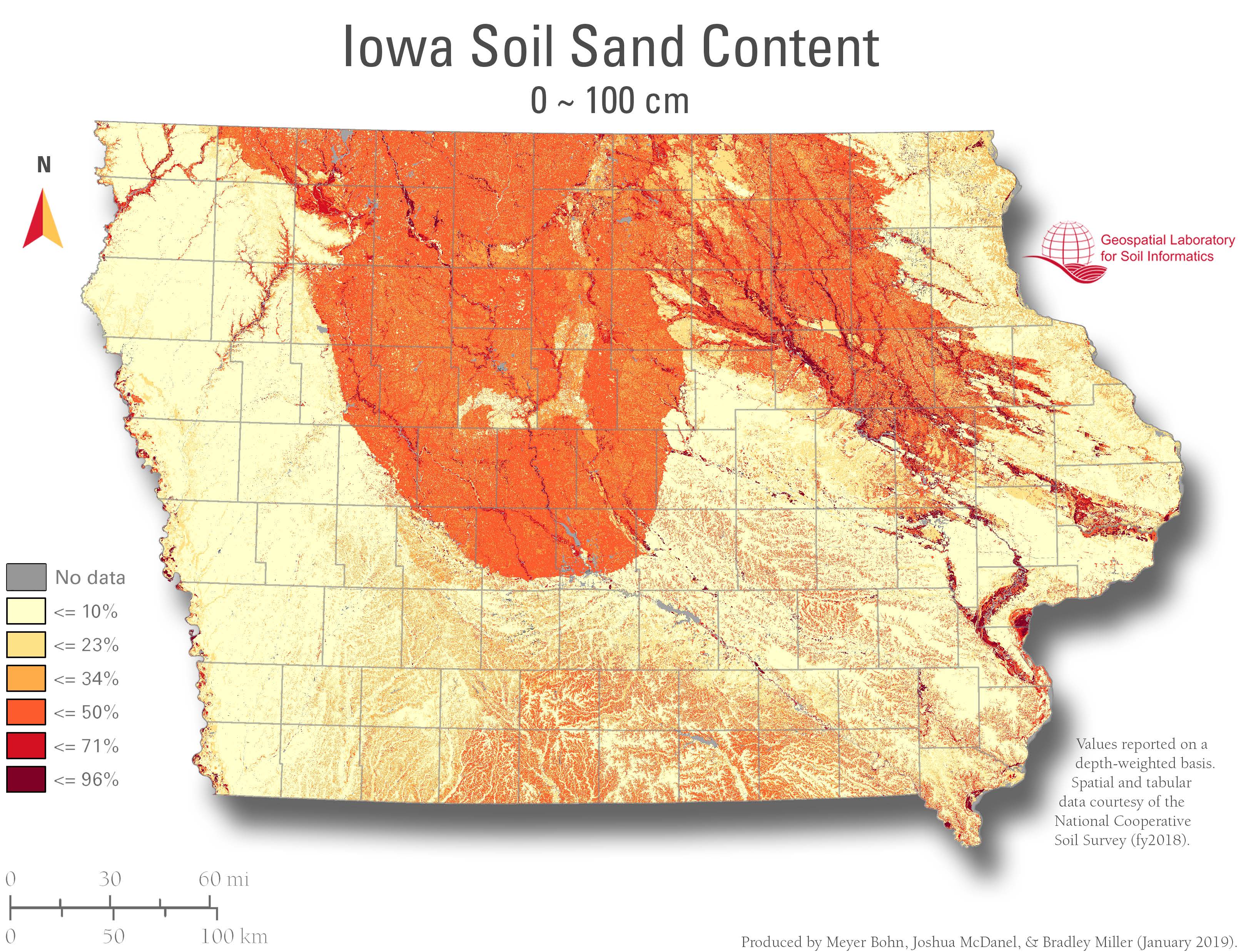
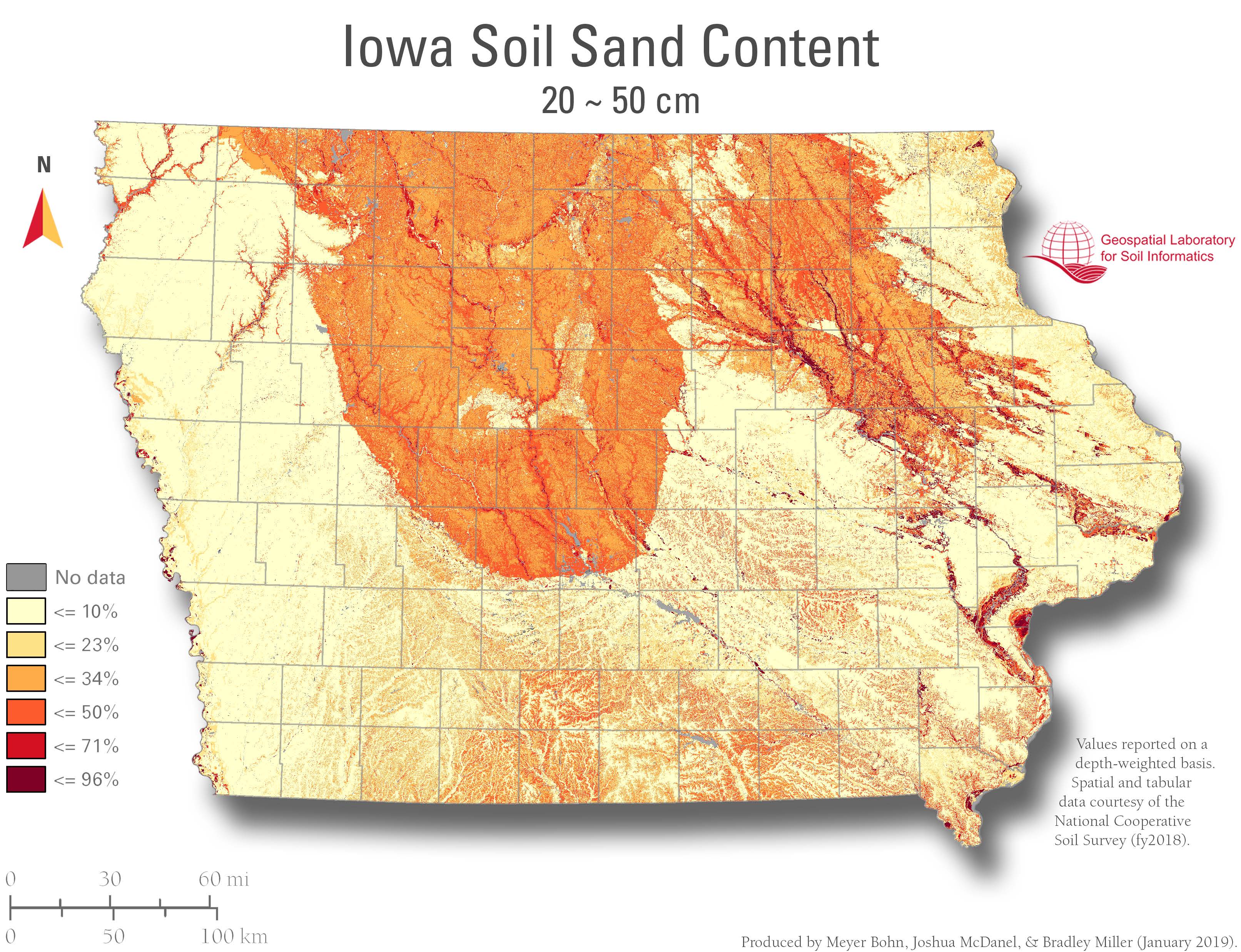
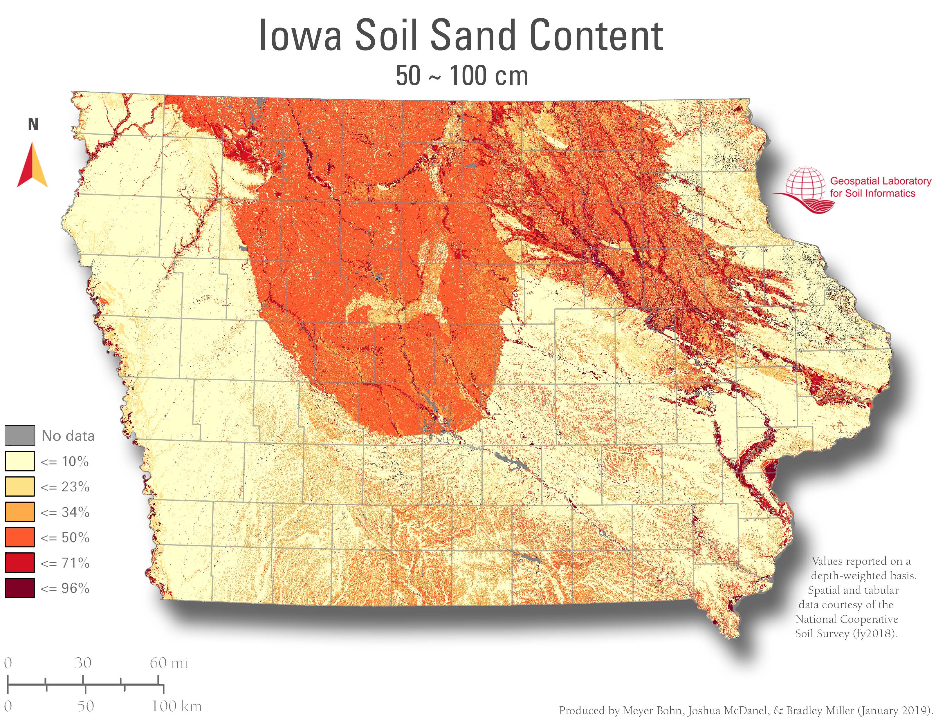
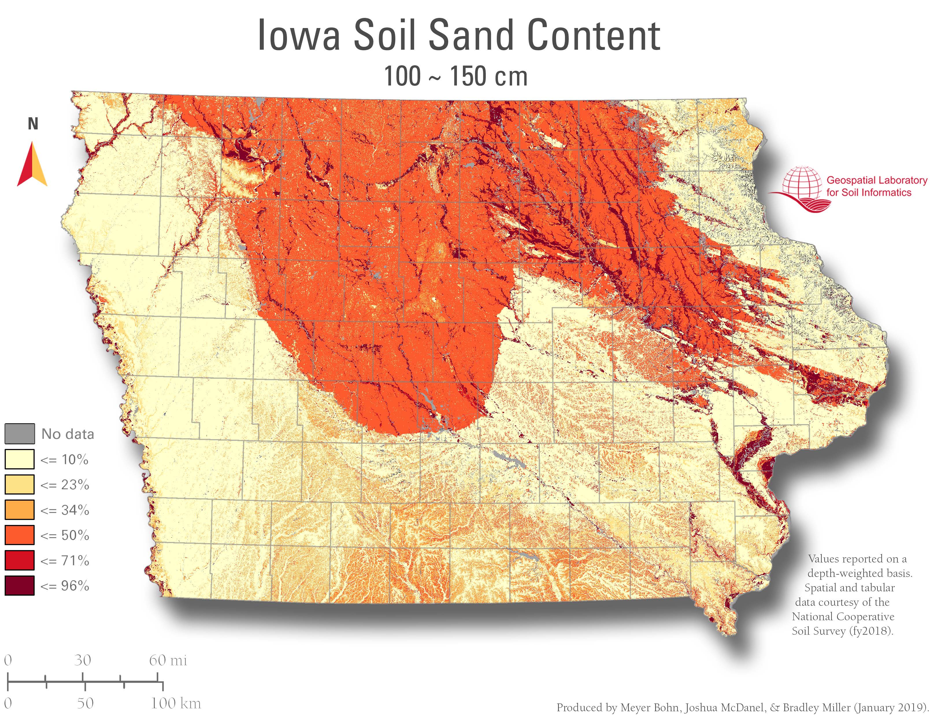
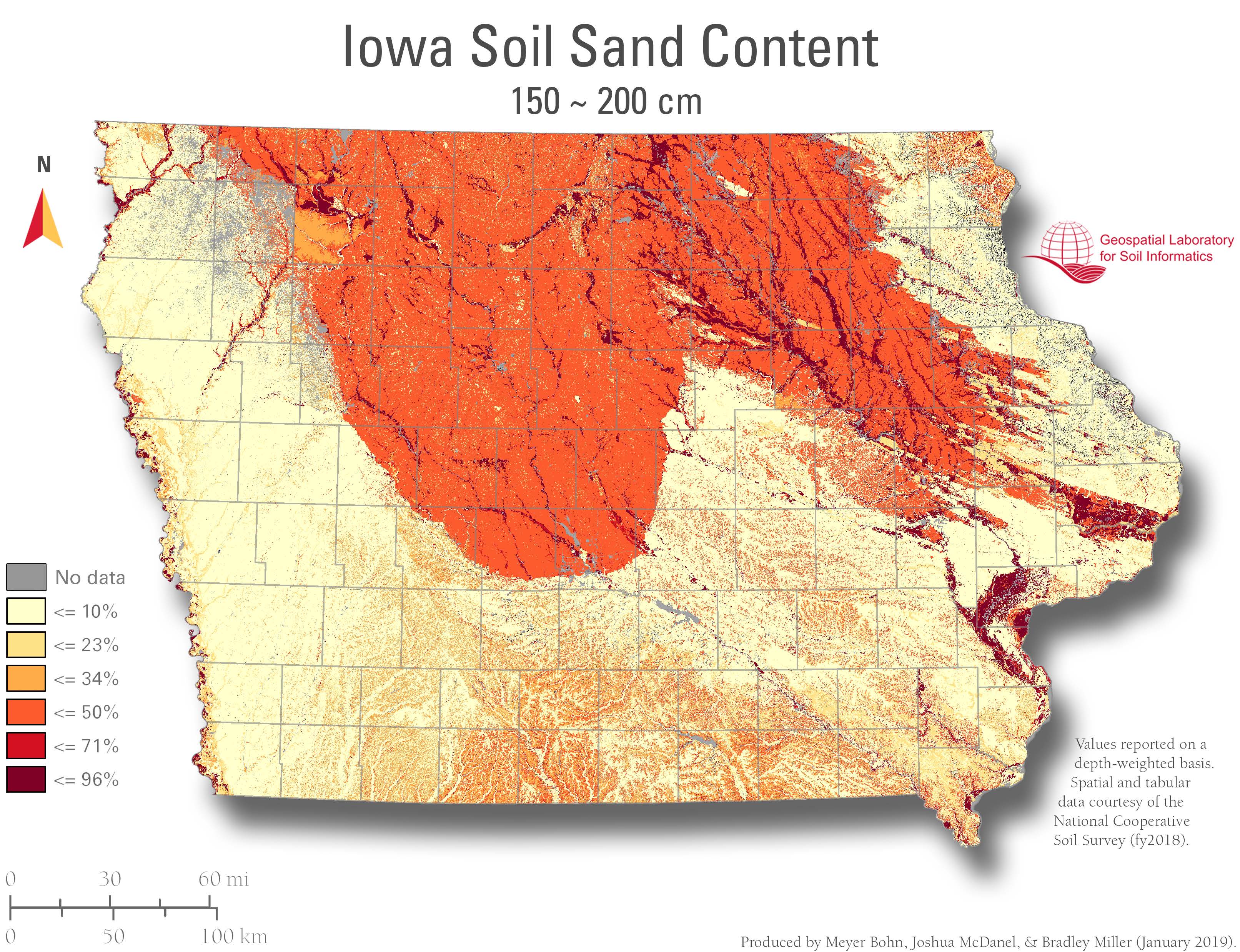
Sand content refers to the percentage by weight of mineral soil particles between 0.05 mm and 2 mm in diameter, measured within the <2 mm soil fraction. This classification helps describe soil texture and physical structure. It’s one of the three primary soil separates, alongside silt and clay.
Applied Relevance
Sand influences water infiltration, drainage, and aeration. Soils high in sand generally have low water-holding capacity and lower nutrient retention. Sand content is essential for interpreting hydrologic behavior, assessing suitability for construction, and determining soil texture class for agricultural use.
Available Depths
Mapped data layers are available for the following soil depth intervals:
0–5 cm, 5–20 cm, 20–50 cm, 50–100 cm, 100–150 cm, 150–200 cm, 0–20 cm, 0–50 cm, 0–100 cm, 0–150 cm, 0–200 cm.