Ask any farmer and they will explain the importance of soil. While seasonal weather can be the difference from a good harvest and a worrisome one, the soil moderates the long-term productivity of that harvest. The inherent properties of soil types are vital to know when it comes to management practices on any agricultural landscape.
“We rely on soil for so many different things, the list can be overwhelming at times,” said Bradley Miller, assistant professor of agronomy at Iowa State University. “You think about why the state of Iowa has the agricultural economy that it does, and that is largely because of the soil it has.”
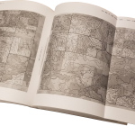
 Miller is working to update Iowa’s soil survey, or soil map, which was completed about 30 years ago, with small tweaks since then. Those original maps were produced by the Cooperative Soil Survey, which was a partnership between Iowa State University and the United States Department of Agriculture’s Natural Resources Conservation Service. Funding for that project came from a combination of federal, state and county sources. The maps were compiled county by county and each took about four years to complete.
A lot of the mapping was done with aerial photography, and while many of the maps may have been completed in the 1980s, the technology that was used to produce the maps was from the World War I era, Miller said.
“We have been essentially mapping soils in Iowa the same way for almost 100 years now,” Miller said. “The concept has been, that we use the aerial photography as a base map. And based on what we see in that photography, we delineate different areas of the landscape with what we believe have similar soil properties.”
With any soil survey comes a certain element of prediction, because a hole can’t be dug everywhere. Miller said maps were made by surveyors building mental models from the experience of taking representative soil samples around each county. They identify all the different environmental factors, like geological and topography associated with that sample, and matched areas with the same factors to predict similar soil samples. This information was combined with the aerial photography to produce the maps, which were hand drawn onto the photos.
Soils are placed in a series, and a series is a collection of soils that have similar properties. Each soil series gets a name, and those names are usually tied to the area, like Clarion, Webster or Nicollet in north central Iowa.
Miller said that the maps in use today were never meant to be used at the sub-field level when deciding management practices for crops, but that is how they are used.
“The existing soil maps were supposed to give a general idea of the soil resources, but as we get into precision agriculture, a lot of farmers—because they don’t have a better resource—are using this map to decide on their management zones within the field,” Miller said. “Even though the creators of this map never intended it for [that], but it is still the best available for that purpose.”
He said when considering the accuracy of Iowa’s soil maps, the question is really about what can be done with the information it provides.
“The reality is that we really want higher spatial detail and a more statistically-based approach in how the uncertainty in predicting soil properties is described,” he said.
 This is what Miller is trying to accomplish through his research. He and his team are working on an algorithm they developed to automatically classify a landscape with different soil properties.
“We have several algorithms as part of our toolbox, and we could do a better map than [the current] map right now,” Miller said. “But every landscape has some special characteristics that we need to customize to, and we do that through machine learning.”
This means that the algorithm “learns” about these characteristics in the landscape without having to specifically be programed to do so. Different technologies Miller is using are being input into the algorithm to be consistent and accurate.
He takes the aerial photography, and stacks together a large number of potential covariates or predictors. This means taking remote sensors, from an airplane or satellite platform, that could predict, or covary, different soil properties. The difference from the traditional soil survey methods is the large quantity of covariates and the complex, quantitative models built by machine learning.
There are two different ways Miller is collecting the covariates. The first is terrain analysis. This starts with detailed elevation data that comes from an airplane equipped with LIDAR, which stands for Light Detection and Ranging. This measures the rise and fall of the landscape and records the elevation information by shooting a laser from the plane to the ground and recording the amount of time it takes to bounce back. Then Miller’s team analyzes the elevation data for the different landscape aspects that influence environmental conditions, such as water flow.
The second method is collecting spectral information from satellites. This means the whole electromagnetic spectrum, both light seen by the human eye and light that can’t be seen. Miller said that healthy vegetation on a landscape is directly related to the plant’s root system in the soil, thus being able to infer the soil based on what it above ground. Miller said that strategy, classifying soil by the vegetation growing from it, actually dates back to the ancient Greeks.
“In some ways we aren’t inventing the wheel, we are using concepts that we have known for a while,” Miller said. “The big difference is we now have this big data source with this satellite information, LIDAR information, plus we have the machine learning that helps us find much more complex patterns.”
 The big questions Miller is tackling now are what is the appropriate machine learning algorithm to find those complex patterns, what is the best sampling design that can capture the variation in the landscape and what are the best covariates to use.
The inventory of Iowa’s soil is important, not only for those in the agriculture industry, but also for tax assessment, real estate valuation and the environment.
“We are always [working] to improve the accuracy of our predictions,” Miller said.